Graphical Abstract
JMSJ, 2016, Vol. 94, No. 2 (April)
Articles
Schubert et al. (2016)
Schubert, W. H., C. J. Slocum, and R. K. Taft, 2016: Forced, balanced model of tropical cyclone intensification. J. Meteor. Soc. Japan, 94, 119-135.
https://doi.org/10.2151/jmsj.2016-007
Graphical Abstract
Highlights:
- This study explores applications of the Salmon wave-vortex approximation to tropical cyclone intensification. The approximation can be used to describe flows with high Rossby number and low Froude number by providing analytic solutions to an elliptic problem.
- Results from the two-region forced, balanced model show why topical cyclones can have long incubation times prior to rapid intensification and provide insight into the size of the mature vortex (Fig. 2).
- Figure 6 shows results from the three-region forced, balanced model. Insight into the formation of hollow potential vorticity (PV) structures and the inward movement of angular momentum surfaces across the radius of maximum wind are provided.
Romanskiy et al. (2016)
Romanskiy, S., and E. Verbitskaya, 2016: The 2013 Amur River flood: Operational numerical simulation of prolonged precipitation. J. Meteor. Soc. Japan, 94, 137-150.
Special Edition on Contributions to Asia Oceania Atmospheric Sciences
https://doi.org/10.2151/jmsj.2016-008
Graphical Abstract
Highlights:
- Areal precipitation data derived from numerical Weather Research and Forecasting model with grid distance of 15 km has sufficiently representative values for hydrological applications related to the Amur River basin. The overall period of precipitation accumulation and lag time of runoff to the outlet points of the partial drainage basins is near 10 days for the proposed partitioning of the Amur River basin (Fig. 1).
- Variations of simulated five-day amount of precipitation averaged over all grid points of a sub-basin (Q5) above and below the threshold value of the five-day amount of precipitation (Qcrit) correlate with peaks and falls of water level at the outlet points of partial drainage basins quite well. If Q5 values exceed Qcrit, then water level on an outlet point of a partial drainage basin increases independently of any variations of precipitation amount above Qcrit. The Qcrit for all partial drainage basins of the Amur River is 20 mm. This rule works for a relatively simple riverine basin (e.g., the Shilka and the Argun Rivers). Peaks and troughs of water level are also noticeable for a complex riverine basin (e.g., the Upper Amur River), but value of water level on an outlet point is the sum of runoff and discharge of tributaries and sources shifted on lag time (Fig. 2).
- The most suitable for hydrological applications variant of Q5 is a simulated five-day amount of precipitation averaged over all grid points of a sub-basin. Observed values of Q5 do not always correspond to water levels at an outlet point, because the amount of observational stations is not sufficient for that vast territory. Simulated Q5 values averaged over all grid points are more relative to dynamics of water level on the outlet points of the sub-basins than simulated or observed Q5 values averaged over all observational stations of those territories.
Bessho et al. (2016)
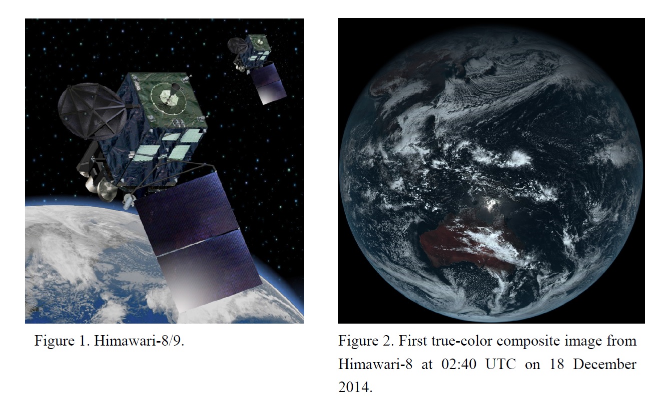
Bessho, K., K. Date, M. Hayashi, A. Ikeda, T. Imai, H. Inoue, Y. Kumagai, T. Miyakawa, H. Murata, T. Ohno, A. Okuyama, R. Oyama, Y. Sasaki, Y. Shimazu, K. Shimoji, Y. Sumida, M. Suzuki, H. Taniguchi, H. Tsuchiyama, D. Uesawa, H. Yokota, and R. Yoshida, 2016: An introduction to Himawari-8/9 - Japan's new-generation geostationary meteorological satellites. J. Meteor. Soc. Japan, 94, 151-183.
https://doi.org/10.2151/jmsj.2016-009
Graphical Abstract
Highlights:
- A Japanese new-generation geostationary meteorological satellite of Himawari-8 was successfully launched on 7 October 2014. The Japan Meteorological Agency has commenced the unit’s operation from 7 July 2015. Himawari-9 will also be launched in 2016 for in-orbit standby service, and will eventually replace Himawari-8 (Fig. 1).
- Figure 2 shows first true-color composite image from Himawari-8. It carries state-of-the-art optical sensor of Advanced Himawari Imager (AHI) with significantly higher radiometric, spectral, spatial and temporal resolution than those previously available in geostationary orbit.
- This paper provides an overview of the Himawari-8/9 satellites. In the first half of the paper, the basic functions of the satellites, their ground segment, the specifications of AHI and the imagery and data distribution/dissemination scheme are explained. The physical retrieval products created from satellite observation data are introduced, and the development plan for new products and application are discussed in detail later in this paper.
Takido et al. (2016)
Takido, K., O. Saavedra, M. Ryo, K. Tanuma, T. Ushio, and T. Kubota, 2016: Spatiotemporal evaluation of the gauge adjusted Global Satellite Mapping of Precipitation at the basin scale. J. Meteor. Soc. Japan, 94, 185-195.
https://doi.org/10.2151/jmsj.2016-010
Graphical Abstract
Highlights:
- GSMaP_Gauge (G_Gauge) and GSMaP_MVK (G_MVK) products were compared against ground Radar-AMeDAS in terms of spatiotemporal performance variabilities across the Tone River basin, Japan.
- The probability of detection commonly had negative log-linear relationships to the elevation and this trend was more significant in winter than summer, indicating the seasonal topographic effect on rainfall detection ability (Fig. 1).
- Both products underestimated precipitation intensity particularly in winter (Fig. 2, panels a and e), and G_Gauge overestimated the intensity notably in summer (Fig. 2, panels c and g).
- At any scale, local application of these products should consider seasonal changes and topographic effects. For further improvements of the GSMaP products at the basin scale, we suggest including high resolution gauge-based network data to enhance accuracy.
Choi et al. (2016)
Choi, J.-W., S.-W. Lee, B.-H. Lim, and B.-J. Kim, 2016: Interdecadal change of winter precipitation over southern China in late 1990s. J. Meteor. Soc. Japan, 94, 197-213.
https://doi.org/10.2151/jmsj.2016-011


