Graphical Abstract
Kato, T., 2018: Representative height of the low-level water vapor field for examining the initiation of moist convection leading to heavy rainfall in East Asia. J. Meteor. Soc. Japan, 96, 69-83.
https://doi.org/10.2151/jmsj.2018-008
Graphical Abstract with highlights
Highlights:
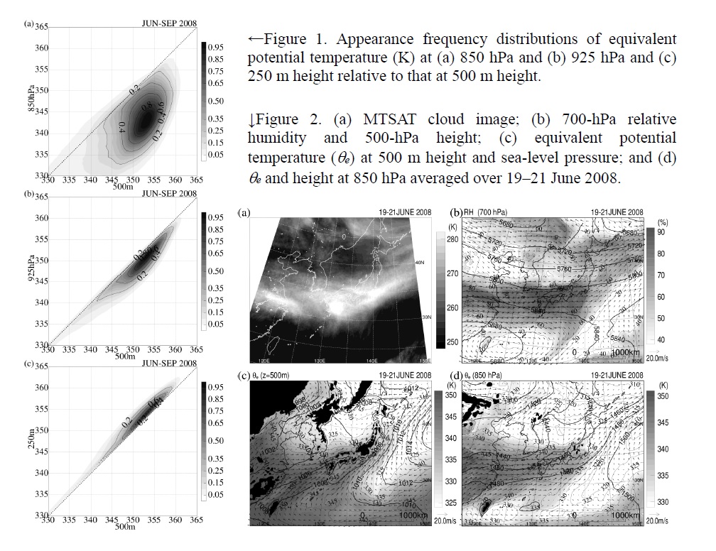
- Cloud base heights of moist convection with strong updrafts were simulated mainly around 500 and 300 m heights above sea level over land and over the ocean during April–August 2008, respectively. This result indicates that low-level humid air below a height of 500 m is very important for the initiation of strong moist convection.
- Equivalent potential temperature θe at 500 m height from 10-km-resolution objective analysis data was statistically compared with θe at various heights and pressure levels over the ocean south of 35 °N in East Asia during June–September 2008. These comparisons (Fig. 1) showed that analyses at the 850-hPa level could not represent the low-level water vapor field. The θe field at 925 hPa also could not adequately represent the low-level water vapor field, but the difference in θe between heights of 250 and 500 m was very small.
- In the Baiu season since the 850-hPa θe distribution, but not the θe distribution at 500 m height, is close to the distribution of a humid region found at 700 hPa, produced by convective activity, it was strongly influenced by convective activity over the Baiu frontal zone (Fig. 2).


