Graphical Abstract
Inoue, T., K. Rajendran, M. Satoh, and H. Miura, 2021: On the semidiurnal variation in surface rainfall rate over the tropics in a global cloud-resolving model simulation and satellite observations. J. Meteor. Soc. Japan, 99, 1371-1388.
Special Edition on DYAMOND: The DYnamics of the Atmospheric general circulation Modeled On Non-hydrostatic Domains
https://doi.org/10.2151/jmsj.2021-066
Graphical Abstract
NEW GA
Plain Language Summary:
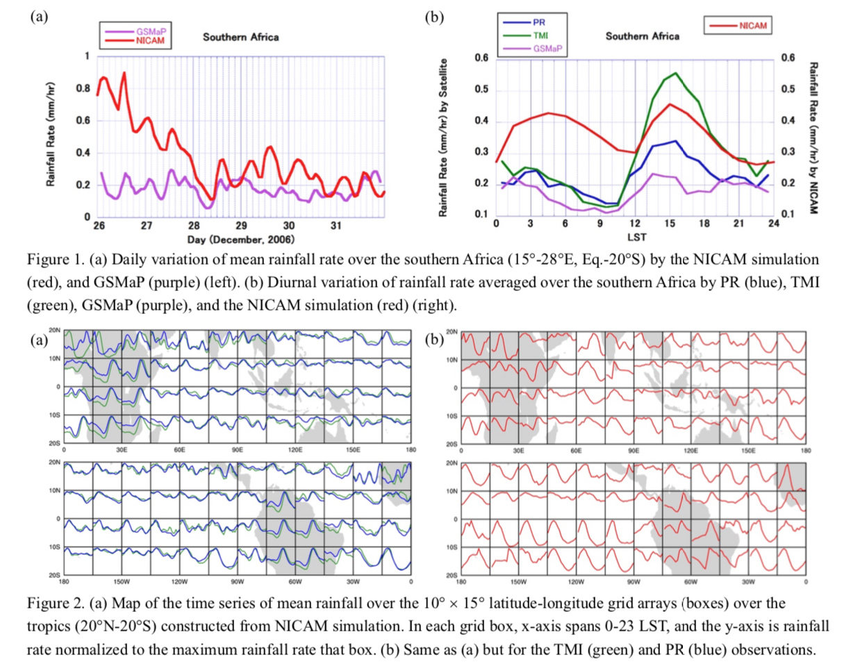
A 3.5-km mesh Non-hydrostatic Icosahedral Atmospheric Model (NICAM) for 26–31 December 2006 simulates the dual peak semidiurnal variation in surface rainfall rate over the tropics. We confirmed this semidiurnal variation of surface rainfall rate from 17-year winter precipitation climatology of Tropical Rainfall Measuring Mission (TRMM) TMI (TRMM Microwave Imager), Precipitation Radar (PR), and the same 6-day data of Global Satellite Mapping of Precipitation (GSMaP), as well as infrared data from geostationary satellites.
Highlights:
- Over southern Africa and the Amazon, the NICAM simulation captures the primary peak in the afternoon and the secondary peak in the early morning, at similar times to those captured by TRMM data.
- In the PR observation, the primary peak of rainfall is mainly due to convective rain, whereas the secondary peak is due to stratiform rain. In the NICAM simulation, if a simple method is used for classification of convective/stratiform rain, convective rain is dominant all day long and the rainfall rate is generally higher than the PR observation.
- In the NICAM simulation, the relative magnitudes of the two peaks are not represented well, and the contribution of the stratiform rain is underestimated.


