JMSJ Highlights
Editor's Highlight : Kanno et al. (2025)
Kanno, Y., S. Sugimoto, and M. Murakami, 2025: Synoptic- and meso-scale features of the heavy wet snow accretion event along the Okhotsk Sea coast on December 22–23, 2022.
J. Meteor. Soc. Japan
,
103
, 45-66.
https://doi.org/10.2151/jmsj.2025-003
Graphical Abstract
Special Edition on Research on "Heavy rainfall and snowfall, and moisture transport"
Editor in charge: Sachiho Adachi
-
We highlight this paper, which elucidates the weather conditions that caused heavy wet snow accretion, leading to the collapse of a transmission tower near the city of Monbetsu, Hokkaido, on December 22-23, 2022. (RainSnow&Moist Special Edition Editorial Committee)
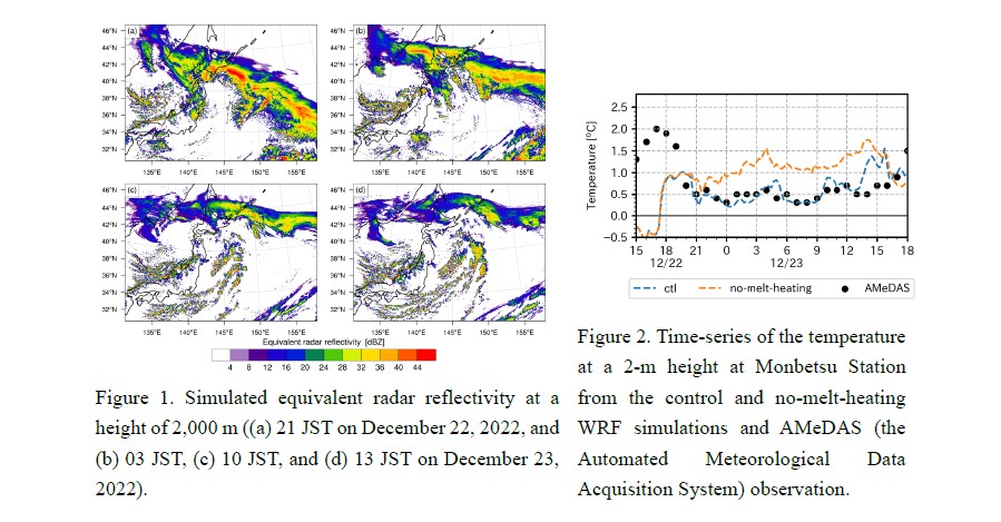
- The low-level moisture transport by the cold conveyor belt of a cyclone approaching eastern Hokkaido enhances snowfall from stratiform clouds through depositional growth.
- A backward trajectory analysis reveals that a balance between heating from the sea surface and cooling from snowmelt was important for maintaining temperatures just above 0°C, creating favorable conditions for wet snow accretion.
- A comparison with past similar cases, based on the analysis of observation data, indicates that this event exhibited the most favorable weather conditions for wet snow accretion in Hokkaido since 1976.

Abstract
Heavy wet snow accretion occurred along the coast of the Okhotsk Sea, collapsing a transmission tower near Monbetsu City and causing a power outage in the area, on December 22-23, 2022. This study investigated the meteorological conditions that caused heavy wet snow accretion in this area, with a particular focus on three factors responsible for wet snow accretion: strong winds, snowfall, and temperatures slightly above 0 °C. An analysis of the station observations from the Japan Meteorological Agency shows that this case occurred on the most favorable day for the wet snow accretion in Hokkaido since 1976. A duration of favorable temperatures for wet snow accretion for this case was longer than historical events by 30%. A numerical simulation using the Weather Research and Forecasting model, with a horizontal resolution of 1.667 km, demonstrated that the formation of torrential wet snowfall and strong winds were associated with multiple extratropical cyclones. On the evening of December 22, a cyclone moving northward off the eastern coast of Japan, together with another stagnant cyclone located over the northern Japan Sea, formed a large cyclonic circulation. The cold conveyor belt, a cold airstream located poleward of the warm front, associated with the northward-moving cyclone, caused strong easterly winds along the coast of the Okhotsk Sea and carried a large amount of moisture there, reinforcing snowfall from stratiform clouds through depositional growth. A backward trajectory analysis showed that temperatures slightly above 0 °C were maintained through the balance between heating from the sea surface and cooling caused by snow melting. The norward-moving cyclone tracks resembled other historical events at Monbetsu, but the precipitation amounts were the largest in this event. These findings suggest that a combination of synoptic-scale circulations and cloud microphysics plays an essential role in the occurrence of heavy wet snow accretion.


